
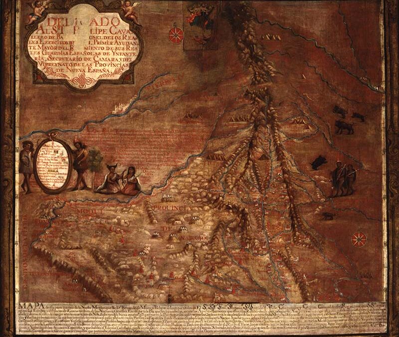
Map of New Spain
Home > Maps, Prints, and Paintings > Map of New Spain

| Maker | Unknown |
| Date of Creation | c. 1760 |
| Location | New Mexico |
| Materials | Oil paint, linen canvas, wood |
| Institution | New Mexico History Museum |
| Credit Line | N/A |
| Accession Number | NMHM/DCA 09599.45 |
| Photo Credit | New Mexico History Museum |
Rendered in oil paint, this representation of the New Mexico region predates its staehood by 150 years and is based upon a map created by Don Bernado Miera y Pacheco delineating the Rio Grande River Valley, its tributaries, animals, people, and flora of the southwest lands claimed by Spain. Reports of the fabled Seven Golden Cities of Cíbola brought the first European explorers into New Mexico in 1540, led by Francisco Vásquez de Coronado. The journey proved fruitless, however, and they soon returned to New Spain (Mexico). After several decades of exploration by soldiers and friars, Juan de Oñate of New Spain was given contracts for colonization in 1595 and made the first permanent settlements a few years later. Santa Fe was established as the permanent capital in 1610. For the next century, missionary work predominated, but attempts to eradicate Indigenous religion and cultural practices brought about the Pueblo Rebellion of 1680, forcing Europeans out of the area for 12 years. By 1700, however, the Spanish had reasserted themselves, and for the next century there was considerable settlement. Albuquerque, founded in 1706, became the focal point in the south, and Santa Fe was the center of the north. Subsistence agriculture in the valley of the Rio Grande and its tributaries was supplemented by the raising of sheep and horses. Trade with the Comanche to the east brought consumer goods in exchange for wool, furs, and horses. The Spanish population increased rapidly, possibly to 25,000 by 1800, making New Mexico several times more populous than the colonies of Texas and California.